
A breakthrough of the flight time of the industrial level UAVs battery
Jun 21st 2016
There's a breakthrough of drone's battery.
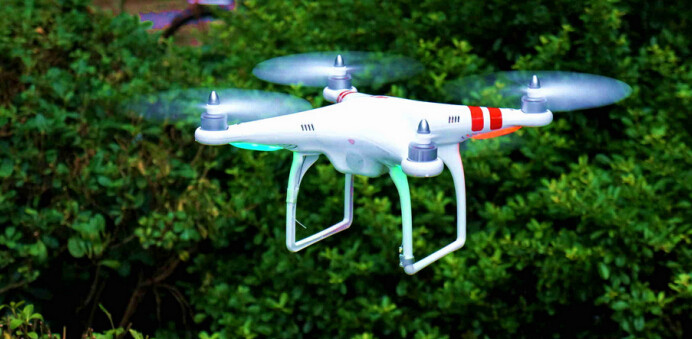
In the beginning of this year, the first domestic high mobility X8 multi-rotor drones with 7*24 hours' flight time was release in Chuangzhi Technology Center, Shanghai, China. This drone is called "skyhook" and adopts irregular ground power transmission system to support the continuous flight. It can carry visible light zoom camera, infrared camera, airborne radar and communication antenna to supervise the security, deal with emergency danger and control the traffic. Those are all the impossible missions for the consumer level drones among the market.
 TATTU is remarkable in the field of battery for drones. The ultra-long flight time, smart battery and protection of low voltage are all the strengths. In the storage, compared with the other battery, the Tattu battery can stop discharging once the voltage reaches 3.5V and self-protect.
In addition to the flight time, the perception and identification is another main problem for drones.
There are three measures to realize the perception and identification. First, depend on the extra sensor, the radar, because it is hard for drones to fly safely in the shared areas without people's supervision and control. Second, identify the object by the drone's camera, which need strong computation ability. Finally, a traditional computation, which need the drone designed to identify or escape the threat by the precise computation, and comprehend how the object is identified while moving. Skyhook adopts that carrying different devices such as infrared camera and laser radar 3D scanning topography, and analyzes by the returned images.
No matter which measure, the key is to let drones know their surrounding, which is very helpful, even though the application scenarios are very limited. For example, they can identify whether there is hole on the frozen roads, find the fires while patrolling in the forest, and find the footprints of the missing climbers.
TATTU is remarkable in the field of battery for drones. The ultra-long flight time, smart battery and protection of low voltage are all the strengths. In the storage, compared with the other battery, the Tattu battery can stop discharging once the voltage reaches 3.5V and self-protect.
In addition to the flight time, the perception and identification is another main problem for drones.
There are three measures to realize the perception and identification. First, depend on the extra sensor, the radar, because it is hard for drones to fly safely in the shared areas without people's supervision and control. Second, identify the object by the drone's camera, which need strong computation ability. Finally, a traditional computation, which need the drone designed to identify or escape the threat by the precise computation, and comprehend how the object is identified while moving. Skyhook adopts that carrying different devices such as infrared camera and laser radar 3D scanning topography, and analyzes by the returned images.
No matter which measure, the key is to let drones know their surrounding, which is very helpful, even though the application scenarios are very limited. For example, they can identify whether there is hole on the frozen roads, find the fires while patrolling in the forest, and find the footprints of the missing climbers.
the breakthrough of flight time
Previously, the flight time mainly hinders the drone scene application. Skyhook makes the continuous flight come true. Compared with the consumer level drones, Skyhook uses a suit of power supply unit form the ground with the power transmission system, communication signal and a cable made of fiber that can connect with the cars or other fixed device on the ground. All of those ensure that the drone can be mobile can work continuously.
TATTU is remarkable in the field of battery for drones. The ultra-long flight time, smart battery and protection of low voltage are all the strengths. In the storage, compared with the other battery, the Tattu battery can stop discharging once the voltage reaches 3.5V and self-protect.
In addition to the flight time, the perception and identification is another main problem for drones.
There are three measures to realize the perception and identification. First, depend on the extra sensor, the radar, because it is hard for drones to fly safely in the shared areas without people's supervision and control. Second, identify the object by the drone's camera, which need strong computation ability. Finally, a traditional computation, which need the drone designed to identify or escape the threat by the precise computation, and comprehend how the object is identified while moving. Skyhook adopts that carrying different devices such as infrared camera and laser radar 3D scanning topography, and analyzes by the returned images.
No matter which measure, the key is to let drones know their surrounding, which is very helpful, even though the application scenarios are very limited. For example, they can identify whether there is hole on the frozen roads, find the fires while patrolling in the forest, and find the footprints of the missing climbers.